
This blog was written in collaboration with Hassan El Tabch

Digital mapping encourages us to think creatively about spatial relationships and realities and how these factors affect human action. Thanks to the emerging digital mapping tools, we are now able to track down the locations of the events of a novel and link them together to figure out a new side of the story. Based on our research questions, we figured out it would be important to explore the unseen relationships between the life of Thomas Hardy and the locations mentioned in his works. Over the past week, we have been exploring how to map literary works digitally through two important tools, Google My Maps & TopoText
“Everything is related to everything else, but near things are more related than distant things.”
Waldo Tobler
Our work is divided into two categories, the first one is about the author himself: his Early life, Career, Literary works and death. The second focuses on tracking the movements of the characters in the novels and the location where these novels occurred. We will use Topotext for the second category to extract the locations that were mentioned and indicate their significance, and then insert them manually into Google My Maps.


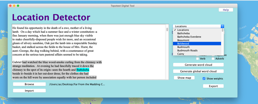
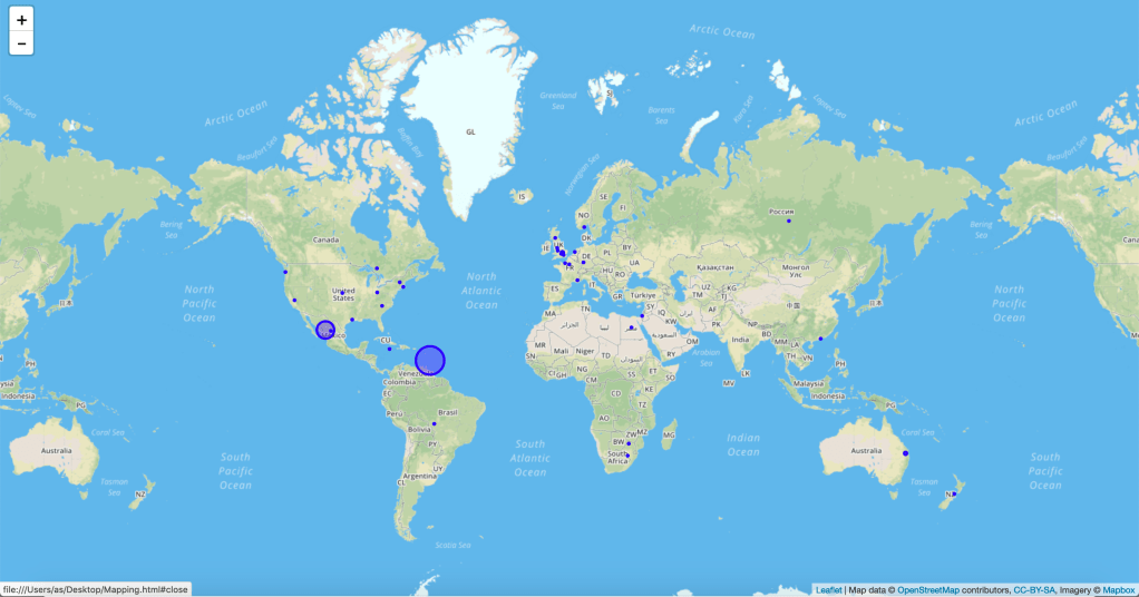
Starting with Topotext, a digital mapping tool that creates maps in addition to word clouds of places mentioned in the uploaded text/novel, we decided to examine Hardy’s Far from the Madding Crowd. Visualizing the locations was pretty straightforward as we were only required to upload the plain text on the software and it will generate the locations on the map, in addition to the number of times each location was mentioned. Topotext also allows us to closely inspect the paragraph where the location was mentioned.
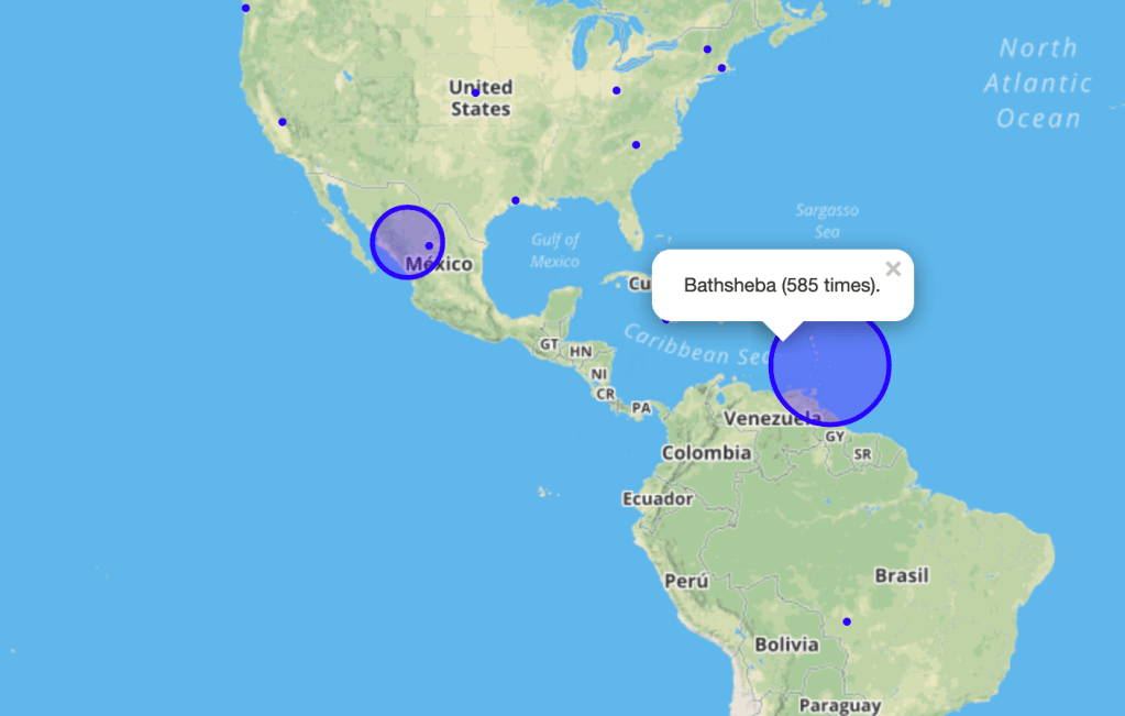
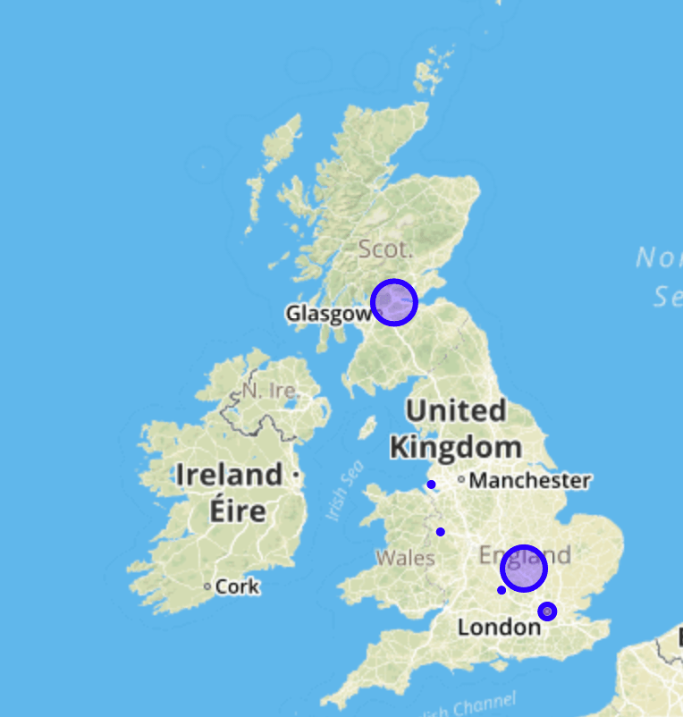
Our results showed places from all around the world, with the majority in the UK, which was obvious since the story’s events were in England. However, we encountered odd results as some locations had a high weight in far countries such Mexico and near Venezuela. After inspecting the Location Detector tab through close reading, it turned out that Fanny (Mexico,98 times)and Bathsheba (South America, 585 times), were actually the names of characters in the novel, indicating TopoText has some flaws that should be considered during our research. Hence, we had to edit the extracted locations to, deleting the non-relevant ones and those related to characters, and keeping the correct locations. After filtering out the results, we started to manually insert the major location into Google my Maps to visualize where the events occurred in Far from the Madding Crowd.
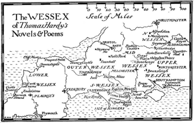
Google my Maps is a tool relatively similar to Google Maps, which we use in our everyday lives, except that it allows you to create your own map by dropping customizable labeled pins all over it. After filling our map, we found interesting observations. We focused on the major locations in Far from the Madding Crowd that hold more significance than others. Most of the events in the novel happened in south and southwest of England and precisely in “Hardy’s Wessex”, which made the digital mapping process somewhat cumbersome as although the places that appear in his novels actually exist, he gave them a fictional name.
Furthermore, Hardy also mentions several locations in his novel that aren’t related to the events happening. He uses historic events, such as the ten disasters inflicted on Egypt by Yahweh, to portray the darkness of the street at night “and black as the ninth plague of Egypt at midnight”. We mapped the locations under two layers, the first layer being the location where the events of the novel took place, and the second layer consisted of the use of location for implicit/metaphorical meanings. After wrapping up, and looking at the locations Hardy used, we were amazed by Hardy’s style, witnessing a wandering mind that wasn’t limited to the country where he grew up, as he rarely traveled.
Our second goal was to map the major locations in Thomas Hardy’s life: His birth, schooling, early career, literary works, and death. Using Google my Maps, we created 4 layers: Birth & Early Years, Early life & Career, Literary Works and death. This visualization allows us to find connections between Hardy’s life and his novels. Indeed, all the layers were located in England, specifically in Dorchester as he lived within the county most of his life. In addition, his novels are also set within the semi-fictitious landscape of ‘Wessex’, named after the medieval Anglo-Saxon kingdom that existed in the southern region of England. In many cases, Hardy gave fictional names to the places in his novels, but they actually refer to real locations. For example, Dorchester, Hardy’s hometown, is called Casterbridge in his books (mainly Mayor of Casterbridge). Furthermore, one of Hardy’s famous novels, Tess of the D’Urbervilles is based in Marnhull, a small village in Dorset. The process of mapping Hardy’s work was very important as it revealed the relationship between the locations where he spent most his time and those in the novels. Hardy’s intense portrayal of the landscape of ‘Wessex’ proves that it holds a place in his heart and was a major influence in his novels. Google My Maps allowed us to see Hardy’s unconditional love for his county, as his heart was buried in a relatively close distance to his birthplace.
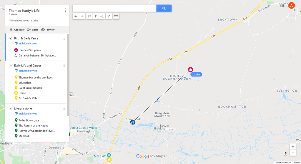
Using Google My Maps was straightforward and easy. To begin with, the tool is highly customizable, it allows you to use custom icons, adding different layers & colors to see what things are at a glance, in addition to adding lines to connect markers to relate between major locations in the novel. Moreover, Google my Maps allows us to add descriptions and images to indicate the significance of each marker. It is also backed-up by Google Maps, which helps providing accurate locations. Relying on Plutchick’s wheel of emotions, setting a color for the pins shows the correlation between the author’s feelings and the location.
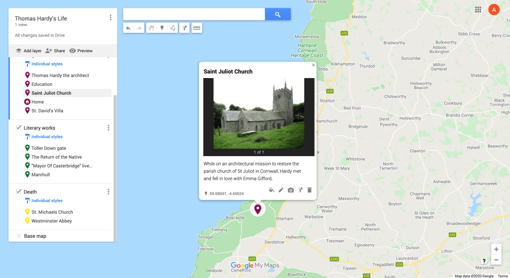
In conclusion, Google My Maps aided us in getting a clearer view of the relationship between events in Hardy’s novels and his life by making connections between locations. By pinpointing relevant locations and providing description and images, we were able to unravel unseen relationships in the author’s choice of locations. Moreover, apart from the novel’s events, metaphorical locations can be visualized through adding a layer that represents locations mentioned but not visited in the novel, such as Egypt in Far from the Madding Crowd. Although Google My Maps requires close reading to extract the locations, complementing it with TopoText would make our analysis easier and more efficient. The generated map didn’t seem more ‘true’ and ‘accurate’ than the novel, since the map can never represent a place in a detailed way, contrary to close reading where the image of a place created in the mind is more true than the one created on the map. For example, in Far from the Madding Crowd, Casterbridge is a simple ‘pin’, excluded from the deep description of Hardy’s unique style. To wrap up, digitally mapping Thomas Hardy’s life and literary works has proved to be important in painting the image of ‘Wessex’ in our minds , and will definetly be included in our timeline to better understand his novels.
 Ali's Blog
Pingback: Reflecting on our final DH project – Ali’s Blog